
These eight maps below show Stonehouse from 1777 to 1953 with links to useful websites.
1777
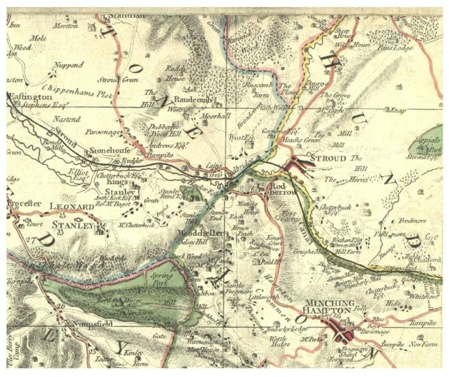
Stonehouse area on map of Gloucestershire by Isaac Taylor 1777, with canals added c1800: reproduced with permission of Digital Stroud Partnership.
This is the earliest known map of the complete area. A suggested plan of Stonehouse c1610 is in SHG Journal 2 page 8
1803
Stonehouse by John Elliott, 1803: reproduced with permission of Gloucestershire Archives, reference D1347/accession 1347, www.gloucestershire.gov.uk/archives
1831
Stonehouse area, reproduced from 1831 Ordnance Survey map, scale one inch to one mile, with the kind permission of the Ordnance Survey, image provided by the National Library of Australia https://nla.gov.au/nla.obj-231921330 .
Preparatory drawing for this series, made 1811, at https://www.bl.uk/onlinegallery/onlineex/ordsurvdraw/, page 11, Cheltenham sheet.
Discussion of placename ‘Oldends’ in SHG Journal 3 page 6
1831
Stonehouse area, 1831 Ordnance Survey map, scale one inch to one mile, with railways added, including Nailsworth branch line opened 1867, reproduced with the kind permission of the Ordnance Survey and with permission of the Company of Proprietors of the Stroudwater Navigation, Gloucestershire Archives reference D1180/10/37 www.gloucestershire.gov.uk/archives.
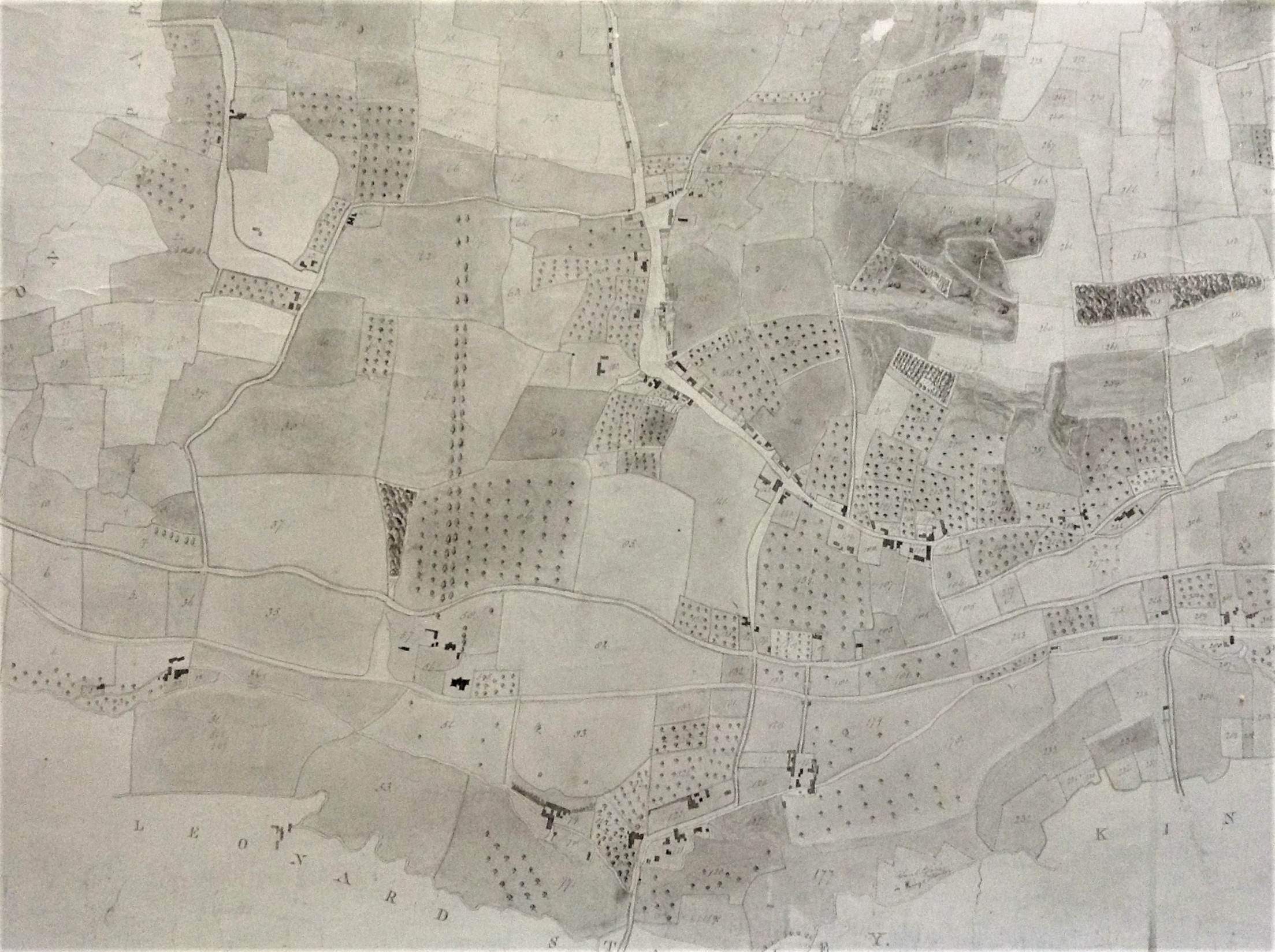
1839
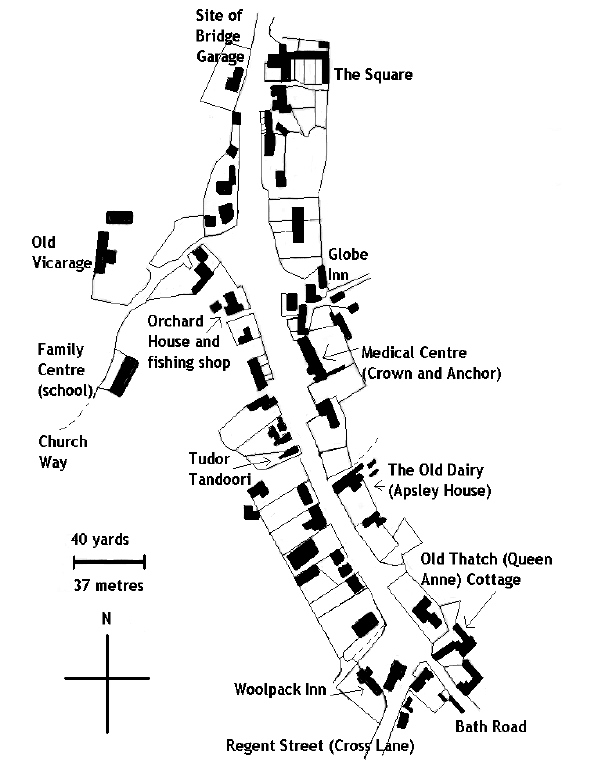
Plan of Stonehouse High Street, based on parish tithe map 1839, © SHG 2010.
Full tithe map at Know Your Place as alternative basemap https://maps.bristol.gov.uk/kyp/?edition=glos.
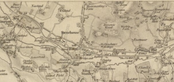
1881
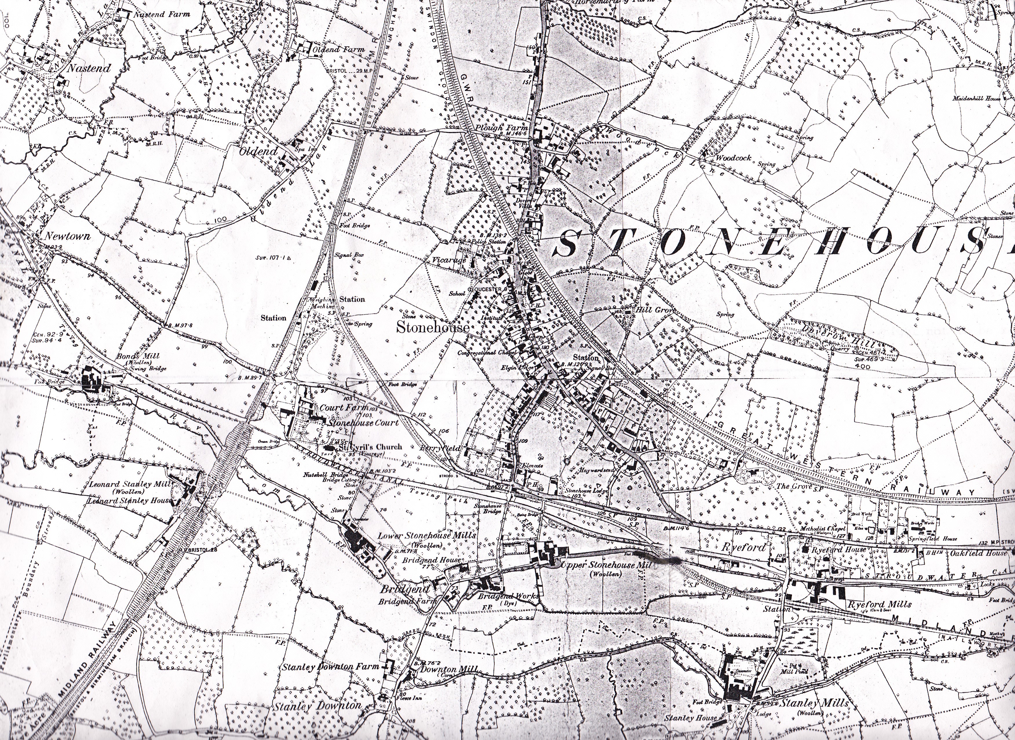
Stonehouse area, surveyed 1881-82, reproduced from 1884 and 1886 Ordnance Survey maps, scale 6 inches to one mile, with the kind permission of the Ordnance Survey.
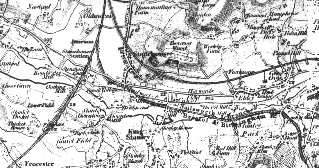
1902
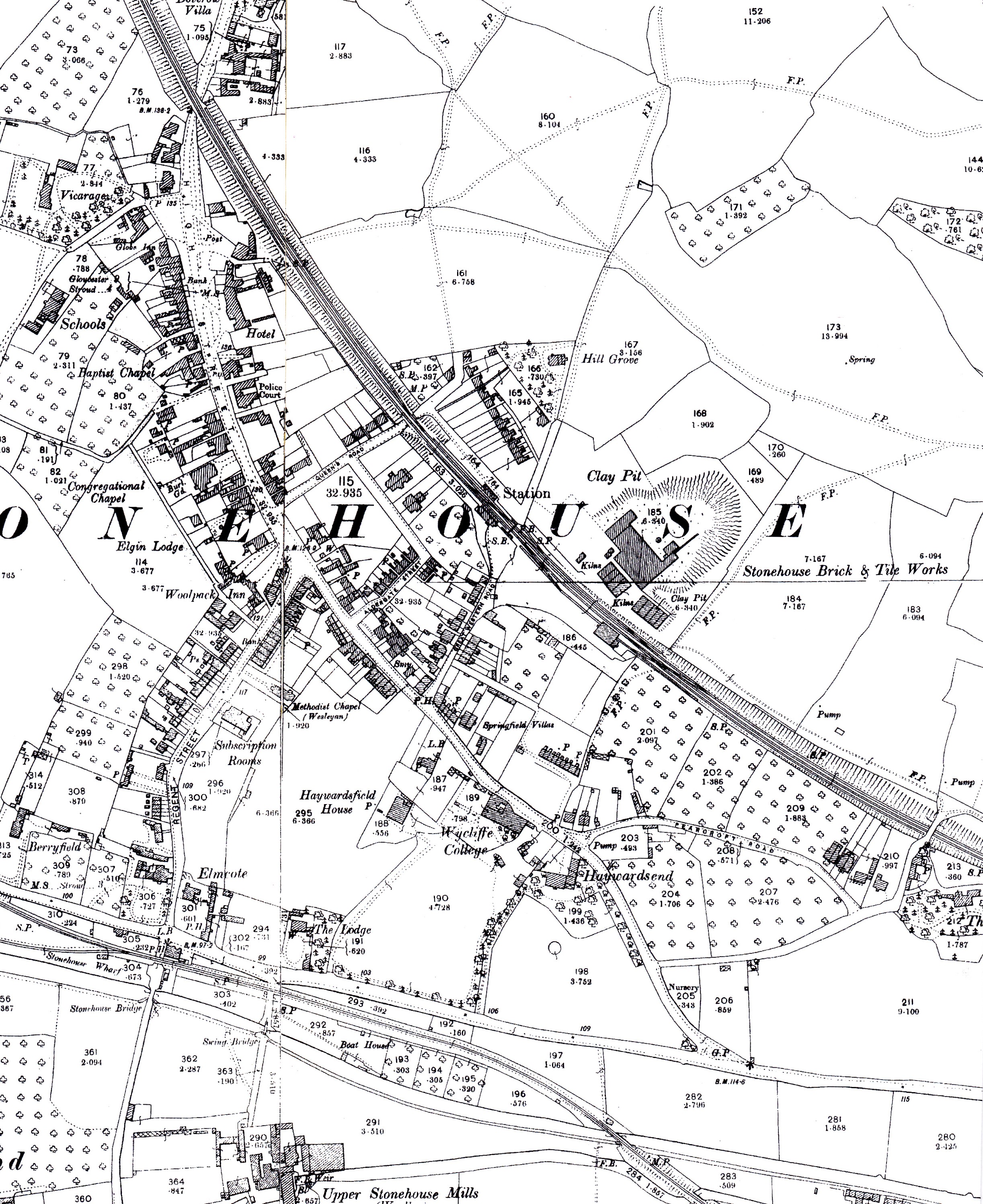
Stonehouse, reproduced from 1902 Ordnance Survey maps, scale 25 inches to one mile, with the kind permission of the Ordnance Survey.
Other Ordnance Survey maps for Stonehouse, surveyed 1881 – 1938, may be seen as alternative basemaps at https://maps.bristol.gov.uk/kyp/?edition=glos
1953
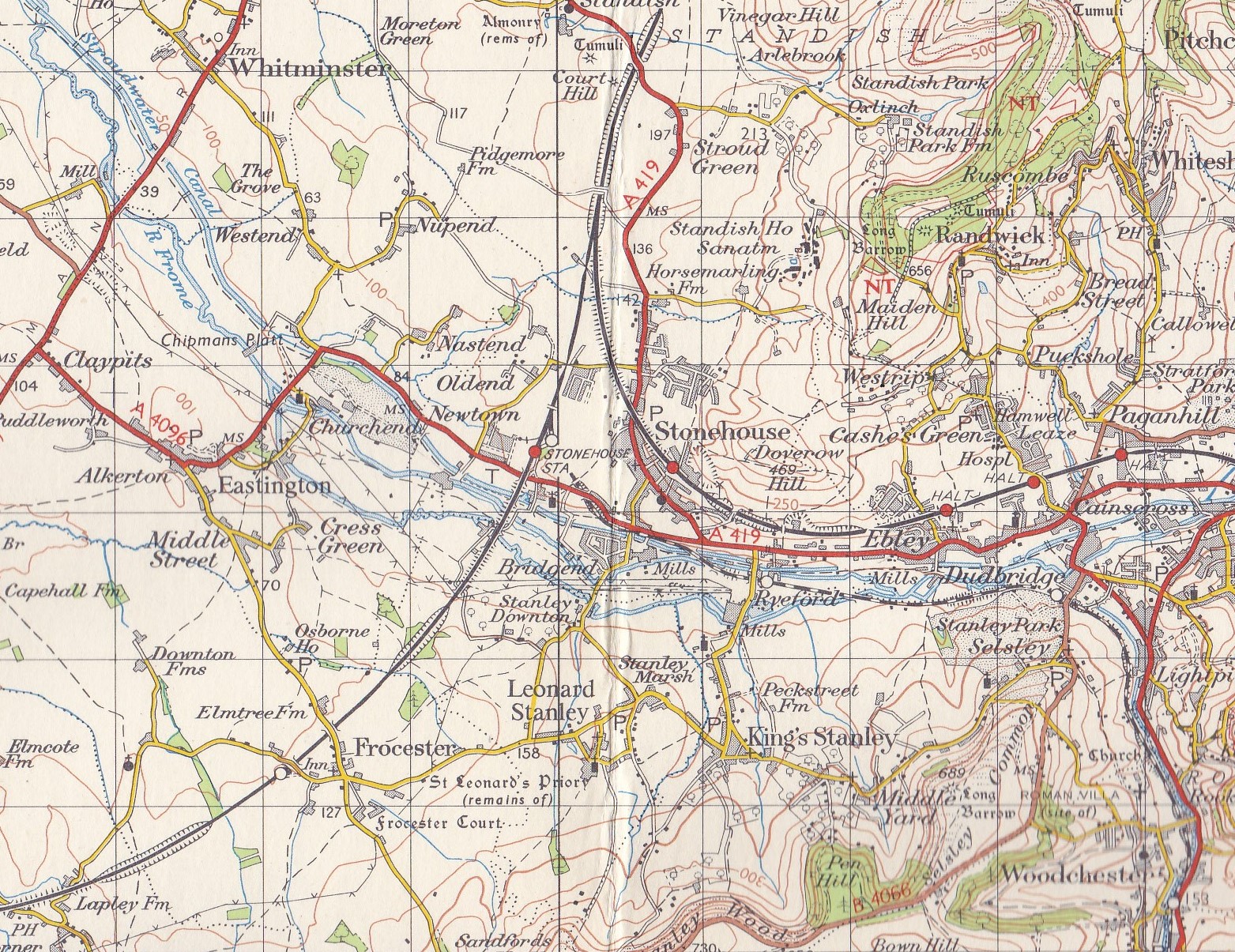
Stonehouse area, surveyed 1949, reproduced from 1963 reprint, with major roads revised, of 1953 Ordnance Survey map, scale one inch to one mile, with the kind permission of the Ordnance Survey.
Other useful websites for maps
Ordnance Survey and Bartholomew maps for Stonehouse up to the1960s at https://maps.nls.uk/index.html
Stonehouse, 2022 town street map at https://issuu.com/standbrook-guides/docs/stroud
Stonehouse area, current road and Ordnance Survey maps, and aerial views, at https://www.bing.com/maps .